 The traditional spot for Mt. Sinai is in the central southern portion of the Sinai Peninsula (Use Google Earth to search for “28 32 20.37, 33 58 30.33”. If you don’t have Google Earth, get it. It’s free. Alternatively, you can click on the title “mt. sinai” above).
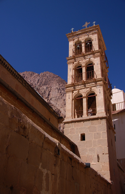
Naturally, there’s a chapel (Greek Orthodox chapel) at the top and a monastery at the bottom. The monastery is named St. Catherine’s. There are several other sites claiming to be “the” Mt. Sinai, but it would appear that this particular general location (not necessarily the exact mountain) has the most going for it from a factual/archaeological/reasonable perspective.
We thought it’d be a great idea to catch the sunrise from the top of Mt. Sinai. What Dr. Dave failed to tell us was that you have to be in really good shape if you expect to see the light of day (from that perch). Thankfully, there were small “coffee shops” along the way from the top. Here’s why:
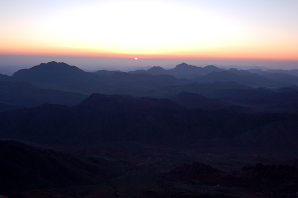
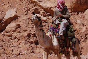
Ground level at Mt. Sinai is about 4,000ft above sea level, so the air is kinda on the thin side. The peak of the mountain top is another 3,000 feet up, for a total of 7,000ft ASL. Going 3,000 feet is not really a big deal until you realize that you’re climbing up a rough path wheezing with every step for lack of oxygen. Not for the faint hearted, that’s for sure. On a good day, it takes about 3 hours to climb to the peak. Sunrise is at 6:15. That means you have to start at about 2:30 if you want to get up to the top in time to catch the sunrise. Well, only a lunatic would try something like that. About 20 of us decided to give it a go. That meant that we’d wake up at about 1am, catch a quick breakfast at 1:30, load the bus by 1:45 to get there by 2:15. To make matters worse, before we left the US, we were told to expect temperatures around the 80s. Lo and behold, it was some 40 degrees when we got there the night before the climb, and there was a slight chance of snow the next morning. Thankfully, there were a couple of Bedoin shops (tents) out in front of our hotel and they sold a variety of thermal underwear, blankets, knit hats and gloves. We got to St. Catherine’s (a monastery at the base of the mountain) at about 2:15am and found out that about 1,000 other people decided to give it a go too. Egads! Good thing some of us had flashlights. Our group of about 20 people had a Bedouin guide named Youssef. He was very nice. Apparently he works the mountain 6 days a week. Within minutes after starting, our group separated, with the faster hikers not waiting for the slower ones. As long as we were in groups of 2 or more, we were fine with that, but Youssef didn’t understand why our group didn’t stay together and help each other out. I told him we were wanting to get up to the top and that we all move at different speeds. He still didn’t understand. “Korean groups. They stay together. Other groups; they stay together. Why American group not stay together and help each other out?” For $13, a Bedouin would be glad to take you up 2/3 of the way on a camel. So if you hear a Bedouin camel-guide behind you yell “CAMEL”, you had to figure out which side the camel was coming and get out of his way – because his camel didn’t mind if you got bumped, and if you were in the wrong spot and he bumped you too hard, it could be a long way down the cliff. Sheryl made it about 3/4 of the way up and was feeling like puking so she stopped at a coffee shop and was content to stay there till I came back down. By this time, most of the people in our group were ahead of us, and it was down to just Youssef and me. “Are we going to be in time to see the sunrise?”, I asked, panting for lack of oxygen. “Oh, yes! Sun at 25 minutes past. Now is 15 before. We have 15 and 25 to get to the top.” He hardly broke a sweat. “40 minutes. *pant* Ok. *pant* Can we make it?” “Oh, yes. From here is 50 minutes, but you fast American. I help you. We take shortcut.” He grabbed my hand and started sprinting for the top, occasionally going off the zig-zagging trail. “CAMEL!!” Sure enough, people moved to one side or another as Youssef dragged me through the crowds. About 400 feet below the summit, Youssef pointed to a particularly rough set of stone steps on a hairpin curve. “Three weeks past, lady fall from here [points to the top of the steps] and hit head here [points to bottom step]. BASH!” It was only a drop of about 5′, but it could not possibly feel good. And it’s not like they have CareFlight out there. “Ouch!” “Yes. Very bad. Let’s go! CAMEL!!” |
||
 |
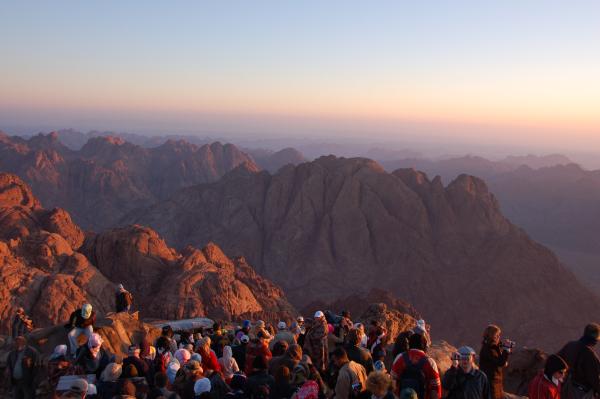
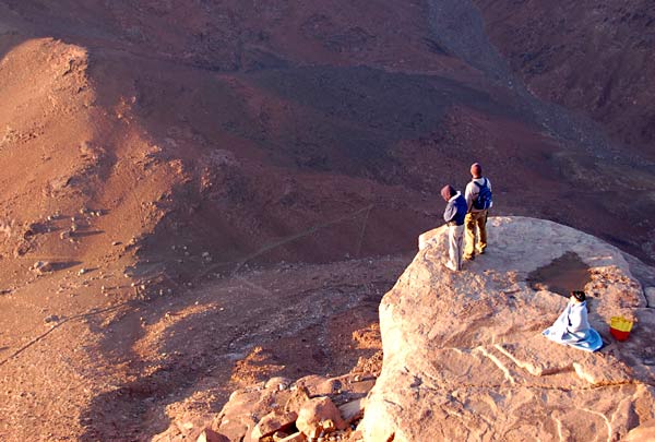
We got to the top with about 10 minutes to spare. Youssef brought me into a coffee shop tent and gave me a cup of hot tea.”You stay here and get warm.” He joined another Bedouin behind the counter and started selling tea and coffee to other passers by. I guess his family/friends owned that particular coffee shop. Within 5 minutes I was ready for the last 150′ up to the top.It wasn’t bad enough that you had to fight the slopes to get to the top, but once you were there, you had to fight the crowd to find an isolated spot with a view. And that usually meant getting out on some precarious perch.
Lovely. Truly lovely! |
|
 |
You can see a Bedouin village down there in the distance. I guess that’s about 3 or 4 miles down below and off to the right. The perch I was on had about a 300′ drop off – not that I leaned over to check. I wonder how many people fall off that mountain top. |
 |
|
 |
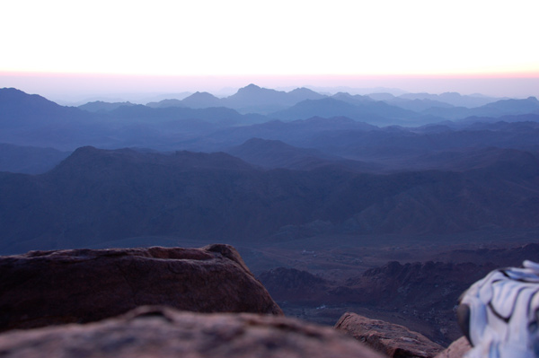
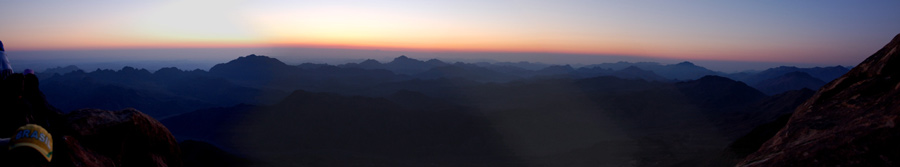
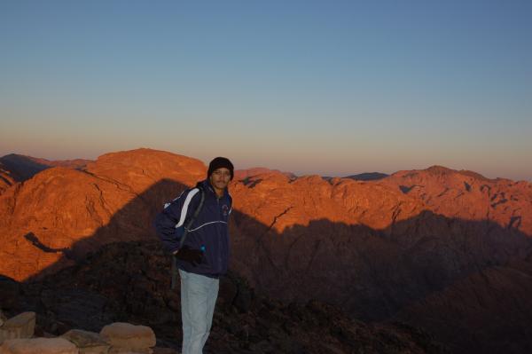
It was gorgeous no matter which way you looked. |
 |
To the west, on the top of the mountain behind me is a small monastery. The path to the top of that mountain starts out at the same place we started out at the bottom of the mountain. Youssef said that monks live there and come down once a week for food and supplies. Yikes!You can barely see the monastery as a small white blip on the third peak on the far right. As best as I can figure, it’s almost 1 mile away, at “28 32 57.58, 33 58 15.35“ |
 |
If you’re a real risk-taker, you could hang out here. I’m thinking they had a 500′ drop to the bottom. That zig-zag line is a path you see waay down there. If there was a car on it, it’d be too small to show up in this photo. |
 |
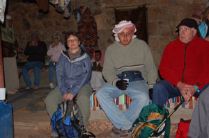
Here’s a spot about 150′ from the top. Youssef’s shop is on the far left. They sell blankets, coffee, tea, candybars. But if you’re not buying, you’re welcome to come in and rest and get warm. Nice people! |
 |
Dr. Dave.Thankfully the descent was much easier (and faster) than the climb. We didn’t have to run or yell “CAMEL” to make it back to the bus in time. |
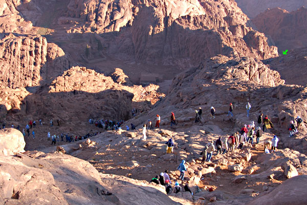 |
The green arrow is near the place where the woman cracked her skull a few weeks back. And yes, those little dots near the arrow are people. |
 |
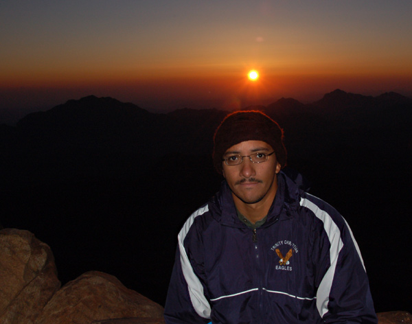
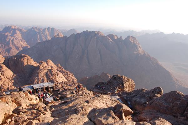
You can see the chapel at the top of Mt. Sinai at the top-right of this photo.I asked Youssef how cold it was this time of year. He reached into his pocket and pulled out a small thermometer. It read 25°F. “No. This wrong. My pocket warm”. Do tell! Turns out it was closer to 10°F. Good thing I had those Bedouin thermal underwear on! “Last week, it was here”. He pointed to -15°F.
“That looks too cold for me!!!” “Oh, yes. I show you.” He reached into his other pocket and pulled out his cell phone and pulled up a couple of photos he had taken last week where there was snow all over the trails. “Today is good. Is warm.” 10°F. Right. I kinda chuckled. Here’s a guy who lives in a meager tent/shack with no running water or no electricity – but he (like most other Bedouin) has got a cell phone. Hey! It’s a connected world, right? “Where do you live?” “My village 25km away,” pointing to the east. “Do you have a bike or motorcycle?” “No. I walk. Or maybe someone on the road drives us.” I assume he meant that he and his fellow guides hitchhiked for the 6 days a week they worked on the mountain. |
A narrow passageway about 1/3 of the way from the top.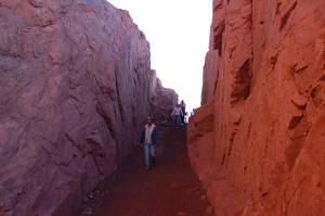
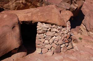
A Bedouin hut used as a rest stop by travelers. That doorway on the left is only about 4′ high. I’ve no idea how they got that rock roof there. I’m guessing it was just there and they built up the stone wall around it |
Youssef pointed to a stone hut on the side of the trail and explained that it was set up by some Bedouin travelers. It’s open for any travelers passing through the area. There was no one in it at the time. He called me over to another hut I had not noticed.”See! You can see sleeping.”
Sure enough, there were 3 or 4 Bedouin travelers sleeping in the stone hut. A small fire kept them warm. “Wow!” “Come.. you can go inside.” “Oh, NO! I don’t want to wake them up.” “It’s ok. You can go inside.” I declined. What was funny was that the hut was only about 30 feet off the trail and I didn’t notice it coming or going. I’ve no idea how he knew there were travelers sleeping in there. |
My friend, Youssef. That’s St. Catherine’s in the background, about 1/2 mile away. Youssef had quite a bit of fun with my GPS. At first he thought it was a cell phone. I had a hard time explaining what it did. He thought the trail drawn on its screen was because the unit knew the trails on the mountain – and it was simply showing which spot we were at on the trail. |
“No, no. It doesn’t know the trails. It only shows where you’ve walked, trail or no trail. Here.. take this shortcut.” I pointed to the trail about 50′ above us. Youssef took the GPS and sprinted up the side of the hill to the trail above us and then followed the zig-zagging trail back down to me, watching the GPS draw a line where there was no trail.
“AH! Now I understand!” he said with a huge smile. “And it even tells you how fast you’re going”. |
 |
His confusion set back in. How a little “cell phone” could tell you how fast you’re moving was apparently too strange. I pointed down the path. “Run, and watch these numbers here.”
Without taking his eyes off the GPS, he sprinted down the crowded path hollering “Excuse me! Excuse me!” How he could do that w/o tripping on the rocks was beyond me. He went a short distance. Stopped. Then turned around and ran back up to me with a big smile. “I like! You go once with guide and then you not need guide again.” St. Catherine’s is a pretty neat monastery with some “very interesting” relics inside. Including the very original well where Moses met Zipporah (*yawn*). |
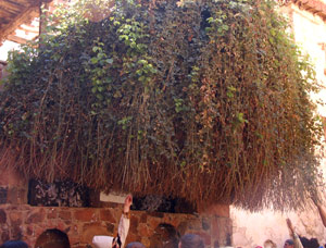 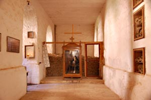 |
And wouldn’t you know it.. just 100 feet away from Moses’ well was the very burning bush that God spoke to Moses from! Amazing that it was still alive after 3,400 years!! It was growing out of the wall. People couldn’t wait to touch it. Inside their chapel (an excessively gaudy and dusty place), people crowded in, jam packed, for an opportunity to kiss the bones of some guy. St. John, I think. “NO PHOTOS!” Darn.This room held a lot of human bones. TONS of bones! They were stacked up behind the glass at the back of this room and in the cubby-holes on the right. There was another room on the left that was piled high with skulls. What’s up with that? I didn’t get a chance to take a photo of the skull room because people were crowding and pushing. |
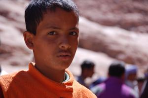  |
I tried to convince a kid to sell me one of his shiny rocks for $1 instead of $10. He didn’t believe me when I told him I was also a Bedouin and therefore his friend. Darn. “Do you know Youssef?”
“Yes. He’s my friend.” “Awesome! He’s my friend too! Sell it to me for $1.” No luck. |
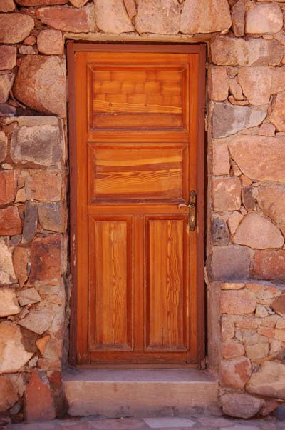 |
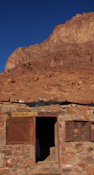
There’s something about doors that I like. Not sure what. Kinda like they’re mysteries because you don’t know what’s behind it. This one seemed to have a lot of character. |
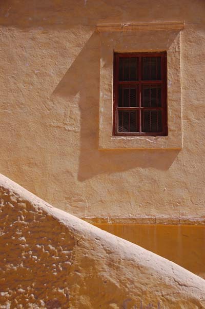 |
Probably my 2nd favorite photo from that day. |
 |
|
| Well.. that’s St. Catherine’s for ya.This was our last stop in Egypt. On to Israel and the Dead Sea!
Crossing the border into Israel is fun. If you ever plan to visit an Islamic country, be very careful if you happen to have an Israeli visa stamp in your passport. Some Islamic countries will not let you into their country if they see an Israeli stamp in your passport! They’ll wait for you to get another passport (weeks!). Lovely. Is it just me, or is that remarkably immature? |